 |
San Juan, Guimar |
The Ruta del Agua (Water Route) is a walk from the San Juan district of Guimar to the old hydro-electric station built in 1924 for the supply of electricity to the town and surrounding district. This took advantage of the very steep terrain and the numerous water gallerias that fed water downhill via a network of tajeas, or water channels.
 |
Plaza de San Juan |
Although I climbed up from the TF28 in the middle of Guimar, it is possible to omit this section and start the walk from San Juan, thereby saving your legs for the very steep climb to the hydro-electric station. The walk has been signposted by the local authorities but much of the information on the signs has been either destroyed by the sun or vandalised, leaving the signposts with a blank plate on top.
 |
Heading into the hills at the start of the walk |
Once the Plaza de San Juan is left on an extremely steep lane to the left of the church, the route is quite easy to follow. Above the buildings, the spectacular bowl of mountains in which Guimar nestles becomes a prominent feature that demands your attention as you puff your way uphill.
 |
Water rushes downhill in one of the water channels |
Fairly early on the in route, you begin to encounter some of the water channels and it's good to see so many still in use on this walk as many of them criss-crossing the island are sadly dry & disused having been replaced by more efficient but less aesthetically pleasing plastic or metal pipes.
 |
The old hydro-electric station |
 |
Very steep staircase alongside water channel
|
As I climbed, the mountains forming the walls of the Barranco de Badajoz, an objective for later in the walk, created an impressive backdrop. Soon, the hydro came into view and standing aside to allow a 4 wheel drive vehicle to pass, I was surprised when the driver stopped and offered me some of the freshly picked 'melocotones' (peaches) from her basket. I took two and thanked her as she assured me that they were 'natural'.
 |
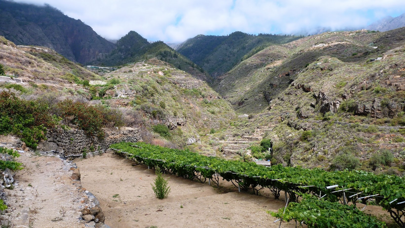
Heading into the barranco |
Continuing, I reached the old hydro building, the disused insulators still attached to the wall being the only clues as to it's former use. The route from here descended incredibly steeply on a stone staircase alongside a water channel plunging downhill and I followed it until around halfway down the hill where the stairs suddenly stopped at the point where a landslip had demolished the staircase.
 |
In the barranco |
After picking my way carefully over the rubble, I continued following a narrow path along the water channel with a fairly steep drop off to my left and continued descending steeply to the floor of the Barranco de Badajoz. Now the walk changed in character completely as I followed a wide dirt track gently uphill into the barranco.
 |
Barranco walls towering hundreds of feet above |
Here, the immensity of the mountains forming the barranco walls was brought into sharp focus as the great towering pinnacles soared hundreds of feet up into the sky. Eventually, I reached the head of the barranco where I found the remains of an old pumping station surrounded by the imposing walls that signalled the limit of my progress and I turned around and retraced my steps back down the barranco.
 |
Looking back into the barranco |
Reaching the outer extremities of habitation, the track became metalled and I strolled back passing 'huertos' heavy with grapevines and other fruit, eventually arriving back in Guimar after a fascinating walk through the history of the region.


No comments:
Post a Comment