Pages

Download Wikiloc trail to Antequera Beach


Powered by Wikiloc

Playa Antequera - Hiking to Tenerife's Secret Beach


Heading into the Hills from Igueste

At the end of the road that runs along the coast from the island's capital Santa Cruz, lies the isolated village of Igueste and it was from here that I started my hike to the 'secret' beach of Antequera. This sandy beach is only accessible on foot through the mountains or by water taxi, so I wasn't expecting much company when I finally arrived at my objective.

Ascending to the Head of the Barranco de Antequera

Ascending to the Head of the Barranco de Antequera
Ascending to the head of the Barranco de Antequera

Leaving Igueste, I followed a narrow lane into the mountains before turning onto a signposted path that climbed steeply uphill, revealing more and more of the stunning scenery of the Anaga Mountains as I gained height. The low gloomy clouds threatened rain but a little light drizzle was all that I had to contend with and as I reached the top of the first climb at the head of the Barranco de Antequera, it was the wind that became the predominant factor but even this abated as I passed a sign declaring ˋAntequera 3.2 kmˋ and began the descent into the barranco.

A Signpost points the Way to Antequera
A Signpost points the Way

As I neared the beach, I heard on the wind the slightly eerie sound of a tin whistle floating on the wind around the hills and, looking across the opposite side of the valley, saw a lone walker climbing along my return route playing as he walked.

In the Barranco de Antequera


Rounding a bend, I had a stunning first glimpse of Antequera beach and the Roque de Antequera below me as the sound of the waves crashing on the shore drifted up the barranco.

Roque de Antequera and Playa de Antequera
Roque de Antequra

The stunning beach of Playa de Antequera
Playa de Antequera

Soon, I was on the sand and apart from handful of hikers, the only others I saw were a few adventurous souls who had taken the opportunity to arrive by water taxi to sunbathe and swim at this near deserted beach. After a break enjoying the sun and the sound of the waves, I eventually located the return path that clung precariously to the cliff-face above the beach before turning into the mountains once again to climb the Barranco de Zapata.

Playa de Antequera, Tenerife
Playa de Antequera

Playa de Antequera, Tenerife

Precarious cliff path from playa de antequera
Starting the precarious cliff path from the beach

Playa Antequera from the return climb through the Barranco de Zapata
Looking back on the climb in the Barranco Zapatera

The steep, knee-crunching descent back to Igueste
The Steep descent to Igueste

The long, arduous climb was accompanied by the haunting sound of the tin-whistle, but though I heard it throughout the climb, I never again saw the walker/musician responsible and I eventually hauled myself to the top of the seemingly never ending climb before beginning the knee-crunching descent back into Igueste with spectacular views to the village and Santa Cruz.   

A Climb to Chindia Waterfall, Tenerife


Video of a beautiful walk to an unusual water feature, a waterfall high in the mountains. This is a walk best done in the spring/early summer as the path follows the Bajante de Fyffes, a water channel that carries water steeply downhill from the falls. Because of this, the path at this time of year is lined with flowers including viper's bugloss and asphodels. 

A Welcome Change - A Damp Walk in Tenerife


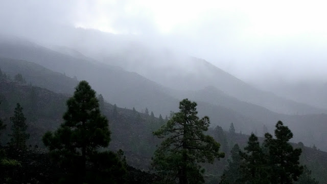
Setting off from Mirador de Chirche at dawn in drizzle as cloud drifts across the jills
Early morning cloud

A planned walk in the Anaga region was changed at the last minute because of a bad weather forecast so I headed off to the Mirador de Chirche to do a walk that I had previously done on a beautiful sunny day last year. Setting off as the sun struggled to pierce the gloomy dawn, I had to wear my waterproof to combat the cold drizzle but as I started to climb, my attention was drawn to the clouds swirling around the nearby hills. 

Setting off from Mirador de Chirche at dawn in drizzle as cloud drifts across the jills
Early morning rain on the hills 

The initial part of the walk followed steep, lava strewn paths through the sodden spurges and houseleeks bordering the path but as I climbed higher, the rain stopped and the clouds broke up to allow short bursts of sunshine to dispel the gloom.    

The clouds disperse as the rain stops and the sun breaks thruogh on the walk from Mirador de Chirche, Tenerife
Sun breaks through, Chirche

As I climbed, I stopped to admire a rainbow over towards the west of the island and as I  continued my climb, the drizzle stopped and the cloud lifted to reveal some excellent views into the nearby baŕrancos.

Rainbow in the west of Tenerife
Rainbow appears in the west

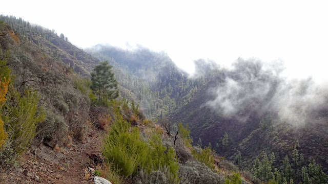
Although the cloud never completely cleared during the walk, it lifted enough to provide me with some superb views and towards the end, the sun put in an appearance causing me to remove layers to stop me from overheating. 

The cloud lifts during the descent into the Barranco de Tamuja, Tenerife
In the Barranco de Tamuja

Walking in  the atmospheric conditions make a welcome change from walking in the usual clear blue skies and warm sunshine that I am used to.

Powered by Wikiloc

A Walk to the Vulture Pine and the Cliffs of the Dead

Stone Oven near Las Vegas Tenerife used for drying figs and baking bread
Stone Oven near Las Vegas

This walk started in the tiny hamlet of Las Vegas that nestles in the slopes below the imposing summits of Guajara and Pasajiron high in the National Park. 

Download the Caldera walk


The route of my recent walk in the Las Cañadas caldera can be downloaded from the Wikiloc app or from this link. The GPX file can also be downloaded from the link.