A short video of recent walk to the isolated beach of Antequera in Tenerife
Showing posts with label canary islands. Show all posts
Showing posts with label canary islands. Show all posts

Playa Antequera - Hiking to Tenerife's Secret Beach
 |
| Heading into the Hills from Igueste |
At the end of the road that runs along the coast from the island's capital Santa Cruz, lies the isolated village of Igueste and it was from here that I started my hike to the 'secret' beach of Antequera. This sandy beach is only accessible on foot through the mountains or by water taxi, so I wasn't expecting much company when I finally arrived at my objective.

 |
| Ascending to the head of the Barranco de Antequera |
Leaving Igueste, I followed a narrow lane into the mountains before turning onto a signposted path that climbed steeply uphill, revealing more and more of the stunning scenery of the Anaga Mountains as I gained height. The low gloomy clouds threatened rain but a little light drizzle was all that I had to contend with and as I reached the top of the first climb at the head of the Barranco de Antequera, it was the wind that became the predominant factor but even this abated as I passed a sign declaring ˋAntequera 3.2 kmˋ and began the descent into the barranco.
 |
| A Signpost points the Way |
 |
| In the Barranco de Antequera |
 |
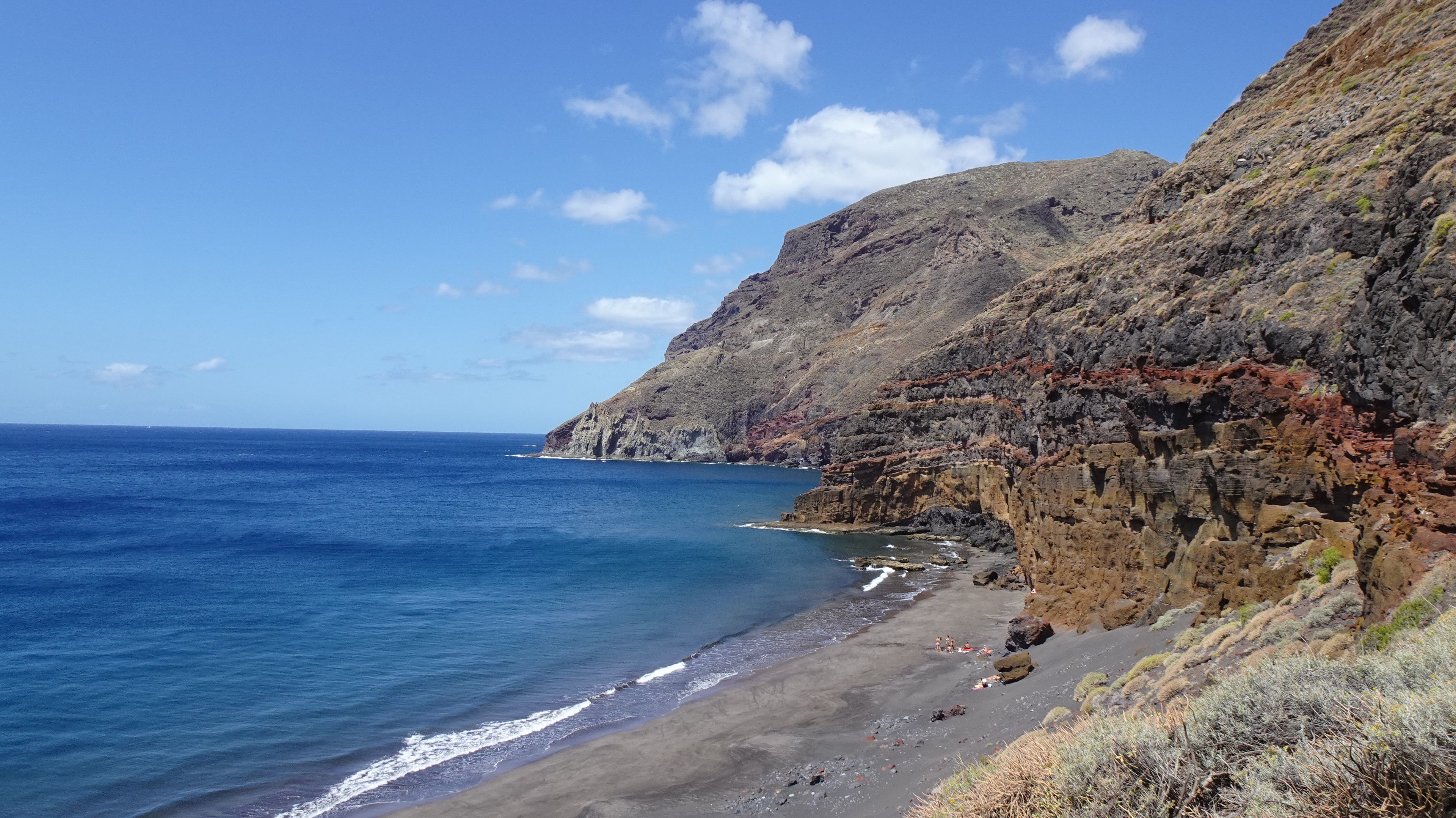
Rounding a bend, I had a stunning first glimpse of Antequera beach and the Roque de Antequera below me as the sound of the waves crashing on the shore drifted up the barranco.
 |
| Roque de Antequra |
 |
| Playa de Antequera |
Soon, I was on the sand and apart from handful of hikers, the only others I saw were a few adventurous souls who had taken the opportunity to arrive by water taxi to sunbathe and swim at this near deserted beach. After a break enjoying the sun and the sound of the waves, I eventually located the return path that clung precariously to the cliff-face above the beach before turning into the mountains once again to climb the Barranco de Zapata.
 |
| Playa de Antequera |
 |
 |
| Starting the precarious cliff path from the beach |
 |
| Looking back on the climb in the Barranco Zapatera |
 |
| The Steep descent to Igueste |
A Climb to Chindia Waterfall, Tenerife

Video of a beautiful walk to an unusual water feature, a waterfall high in the mountains. This is a walk best done in the spring/early summer as the path follows the Bajante de Fyffes, a water channel that carries water steeply downhill from the falls. Because of this, the path at this time of year is lined with flowers including viper's bugloss and asphodels.
A Welcome Change - A Damp Walk in Tenerife
 |
| Early morning cloud |
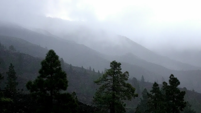
A planned walk in the Anaga region was changed at the last minute because of a bad weather forecast so I headed off to the Mirador de Chirche to do a walk that I had previously done on a beautiful sunny day last year. Setting off as the sun struggled to pierce the gloomy dawn, I had to wear my waterproof to combat the cold drizzle but as I started to climb, my attention was drawn to the clouds swirling around the nearby hills.
 |
| Early morning rain on the hills |
The initial part of the walk followed steep, lava strewn paths through the sodden spurges and houseleeks bordering the path but as I climbed higher, the rain stopped and the clouds broke up to allow short bursts of sunshine to dispel the gloom.
 |
| Sun breaks through, Chirche |
As I climbed, I stopped to admire a rainbow over towards the west of the island and as I continued my climb, the drizzle stopped and the cloud lifted to reveal some excellent views into the nearby baŕrancos.
 |
| Rainbow appears in the west |
Although the cloud never completely cleared during the walk, it lifted enough to provide me with some superb views and towards the end, the sun put in an appearance causing me to remove layers to stop me from overheating.
 |
| In the Barranco de Tamuja |
Powered by Wikiloc
A Night out in Tenerife - A Wild Camping Trip
Video of an overnight hiking trip in the west of Tenerife
A Walk to the Vulture Pine and the Cliffs of the Dead
 |
| Stone Oven near Las Vegas |
This walk started in the tiny hamlet of Las Vegas that nestles in the slopes below the imposing summits of Guajara and Pasajiron high in the National Park.
Download the Caldera walk

The route of my recent walk in the Las Cañadas caldera can be downloaded from the Wikiloc app or from this link. The GPX file can also be downloaded from the link.
Walking in the Caldera, Tenerife
A collection of video clips taken on a recent walk in the spectacular Teide National Park in Tenerife
Climbing Baracàn from Puerto de Erjos, Tenerife
Video of a recent walk to the summit of Baracàn in the Teno
Descent into Heaven - Walking to Afur

An early morning start from Mirador Pico del Ingles in the Anaga Mountains was short on views as mist drifted across the mountains obscuring the stunning vistas from the viewpoint. The objective for the day was the tiny village of Afur, nestling in the bottom of the awe-inspiring Barranco de Afur. The walk involved a descent and ascent of a thousand meters and initially the beautiful laurisilva forest more than made up for the lack of expansive views in the early part of the walk. Later, as the mist cleared and the trees thinned out, superb views emerged revealing awesome mountain scenes in every direction. Continuing the very steep descent, Afur eventually came into view below and as I reached the outskirts, I crossed the Afur River and stood for a while watching the unusual sight of ducks waddling alongside the river, which is one of the only constantly flowing streams on the island. Pausing for a break in the village, I sat trying to imagine living in such an isolated yet stunning location, where everything is a long drive away along narrow, winding mountain roads. Having rested after the descent, the long return ascent began, but the incredible scenery as I huffed and puffed uphill was more than ample reward for the effort involved.
Montaña del Cedro and the Barranco de Tàgara
 |
| Montaña del Cedro |
The sun was just rising over the mountains of Las Cañadas as I climbed out of the caldera towards the summit of Montaña del Cedro from the Narices del Teide mirador. Having reached the summit, the views were simply spectacular with a 360 degree view that included Teide and Pico Viejo, Las Cañadas with the lava fields of the Las Narices eruption in 1798, the three western islands, the Teno Mountains as well as Playa de Las Americas and the west coast. After a break on the top, I headed very steeply downhill and into the Barranco de Tàgara. The path in the barranco was a real 'Indiana Jones' job, with many large fallen pines blocking the trail, as well as fallen boulders and overgrown foliage. The climb out was a little better, but not much, as the path was again overgrown and strewn with boulders and the top of the path had been destroyed by a landslide. Once out of the barranco, the walk, although steep at times, was much easier with clear paths to follow. Despite the difficulties, the stunning scenery made this one of the most memorable walks I have done recently.
Refugio Casa de Chasogo
 |
| Sun rising over Pico Viejo |

Yesterday morning, I set off early as the sun was rising over Pico Viejo to climb to the Refugio Casa de Chasogo from the TF38. The first half of the walk was a long cliimb through open countryside with good views to Pico Viejo and the pine-clad slopes of Montaña Chasogo, which sits behind the refugio. After passing the refugio, the character of the walk changed as the route entered the beautiful Corona Forestal pine forest, the green of the trees combining beautifully with the harsh volcanic lava fields. Overall, the walk was 13.75 kilometres with 740 metres of ascent/descent.
A Hike to Cho Pancho Recreation zone

This walk started from the village of El Roque and climbed steeply to the Cho Pancho recreation zone. The weather when I walked it wasn't ideal, with the hot and hazy conditions restricting what would normally be some impressive views, however, my early start meant that I finished walking before midday when it was starting to get very hot. The early part of the walk followed a well engineered, cobbled path that wound it's way comfortably up the hill and was dominated by excellent views to the volcanic dome of Roque de Jama, with Montaña Guaza just visible in the background through the haze. The Cho Pancho recreation zone made a welcome break in the shade of the pines just after the halfway mark and here I took advantage of the picnic tables to rest and cool off.
Thanks to John and Alison Mackenzie for the route, which I obtained from their excellent website Walk Tenerife Sur: Under 10km https://tenerifesurunder10k.wordpress.com
Hiking Tenerife's Wild Barrancos

The attractive Mirador de Chirche sits above the village of the same name and gives expansive views to the coast and inland to the mountains. The terrain in this area is characterised by very rugged volcanic lava fields and although there are few notable peaks, the countryside is riven with impressively deep and wild barrancos. Leaving the mirador car park required a fleece layer to keep out the cold as the early morning mist swirled around the hills and as I climbed through the lava-fields, I was impressed by the huge amount of giant aeoniums growing in the harsh landscape as rays of sunshine shone through the mist illuminating the fine droplets and giving the whole scene a magical feel. Reaching the Galeria Tamuja, I admired the views into the Barranco Tamuja before returning to the main route and climbing to a junction with the TF-PR70 footpath. The remainder of my walk followed this path back to Chirche as I crossed the Barranco Tamuja and the Barranco del Cedro and pausing in the first of these, I enjoyed a break and sat absorbing the silence and admiring the wild and rugged scenery. Continuing, I crossed the barranco before arriving at the even more impressive Barranco del Cedro. After a steep descent and ascent, I arrived at a spectacular viewpoint looking down to the Galeria Tamuja that I had passed earlier in the walk, now far below me. Climbing out of the barranco, I reached a junction and turned downhill and followed the very steep, rocky path back to the Mirador.
Getting up Teide's nose - a hike to Las Narices
Earlier this year, I set off early morning for a hike to Las Narices del Teide, or the Nostrils of Teide. This is the site of the 1798 eruption on the flanks on Pico Viejo, the summit of which is the second highest point on the island. I was following a path that I had never walked before called Sendero 9 and it turned out to be quite an awful slog on a steep path of deep, loose picon and rubble. The views of the crater at Las Narices and the surrounding mountains were superb however and I even had the added bonus of spotting a flock of wild Mouflon mountain sheep off in the distance. The following is a video I made of my hike.
Climbing Guajara, one of Tenerife's Highest Mountains
Montaña Guajara, at over 2,700 metres high, is one of Tenerife's highest peaks and is an exhilarating climb giving stunning views of the Las Cañadas National Park and Teide. In January 2020, I set off early on a freezing morning for a solo climb to the summit. Having set off at around 8am, I had the mountain to myself and enjoyed the peace and quiet as I ascended to the remains of the world's first ever astronomical observatory on the summit. This is a video I made of my climb. The route can be downloaded from Wikiloc HERE
Download Trails to your device with Wikiloc
Many of my hikes are recorded using an app called Wikiloc. This is a useful tool that allows you to follow walks recorded by other walkers as well as recordng your own, all on your smartphone. You are also able to send files to a Garmin handheld GPS device as well as downloading GPX files to a laptop for free. A data signal is not required if you are using a phone, just make sure that your phone's GPS is switched on (usually called 'location', or similar) and put the phone into airplane mode to preserve battery for the duration of your walk. If you want to download walks directly to your phone from the app, a small subscription is required. It is possible to check your position on a walk by checking the blue dot on the map. When you have finished your walk, simply save it and select 'private'. Once back home, you can add a description and photos before changing the settings to 'public. The app can also be set to alert you if you stray off of the route you are following. Photos and waypoints can be added to a route as you walk. My Wikiloc hikes can be found on this link

Walking in a Mountain wonderland in Tenerife

The Teno Rural park in the west of the island is probably best known as the location of the village of Masca, where tourists flock in their thousands to explore the remote, idyllically situated village and walkers to stretch their legs in the barranco down to the sea. Yesterday morning, as I drove through, I was early enough to have the place to myself as I headed further up the valley to the village of Carrizal Alto. Leaving the car and the main road, I descended the narrow road from the slumbering, upper village to Carrizal Bajo, as I admired the surrounding mountains and impossibly steep cliffs that sheltered the villages from the strong wind that blew isolated puffs of cloud across the tops of the mountains. On the outskirts of the lower village, I left the road to begin a mountain walk that will rank among the best I have ever done. Soon, I was climbing steeply from the Barranco Carrizal as gusts of wind tugged at my clothing and the views became ever more expansive. Cresting the top of the first ridge, I stood agape admiring the sea of peaks and ridges spread out around me as far as I could see, clinging to the rocks to avoid being blown from my lofty perch.
The Amazing Anaga Mountains in Tenerife

For me, the most beautiful part of Tenerife is The Anaga Mountains in the far north-east of the island and this walk didn't disappoint. The initial part of the walk to the cave-house village of Chinamada was impressive enough but from there, the long descent into Barranco del Tomadero on the path to Los Batanes was simply epic. Surrounded by jagged, towering peaks and beautiful flora, this path entered a magical world of trickling streams, rock pools, croaking frogs and cave houses. At one point, the 'path' was nothing more than a few narrow footholds in the rock accompanied by chains as handholds to assist you.Reaching the tiny hamlet of Los Batanes, the climbing began and for around two hours, the path climbed relentlessly up, while the stunning views helped to take your mind off of the climb. In all the walk took 6 hours.
Moonscapes and Waterfalls in Tenerife
A walk to the Lunar Landscape and Fuente Madre del Agua waterfall in the south of Tenerife
Subscribe to:
Posts (Atom)